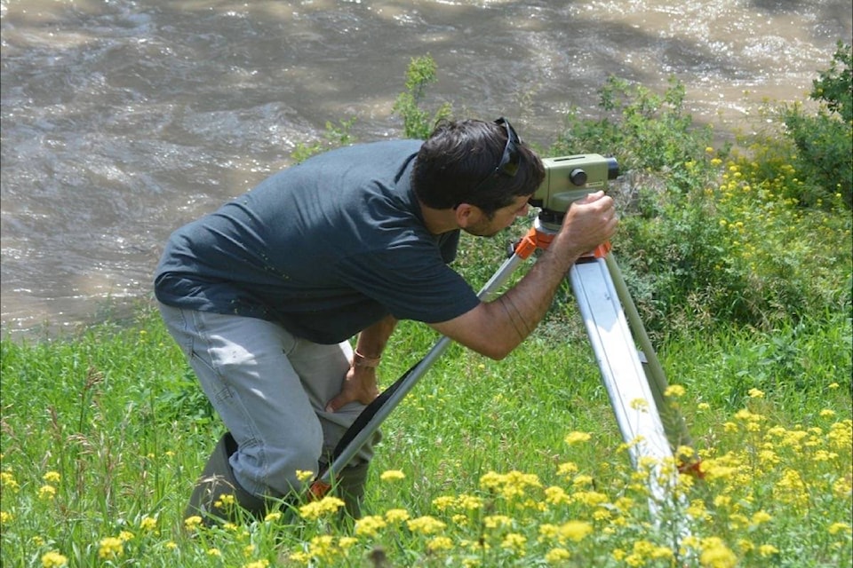
A hydrometric technologist with Environment and Climate Change Canada did a manual water level check at the Water Survey of Canada site at Wineglass Ranch on the Chilcotin River on Tuesday, July 9.
After 100 mm of rain fell in the area during a five-day period, the Chilcotin River and it tributaries swelled last weekend.
The Chilcotin River reached flows over 1,100 cubic metres per second which was over the 200-year return period, peaking on July 9.
The Wineglass Ranch is located near the confluence of Big Creek and the Chilcotin River and Big Creek had also flooded its banks.
Blaine Bowe, performed the check using a survey level, with assistance from Steve Goodliffe, his pilot with Highland Helicopters out of Williams Lake.
Normally the building housing the instrumentation equipment is perched on dry land, but because the Chilcotin River had eroded about 30 acres of the ranch land adjacent the to river the building, while stable, had water flowing under it.
Dave Hutchinson, manager of B.C. District Hydrometric Operations, Monitoring and Data Services Directorate, Environment and Climate Change Canada, said technicians regularly perform manual checks of the water level against a known benchmark throughout the year, and during extreme events, to ensure gauge instrumentation is performing within expected limits.
Debris and sediment moving through during extreme events can impact the measurement of water level recorded by instrumentation installed on site, he added.
“The manual water level reference check ensures that downstream users of the data collected at the gauge are of the highest quality possible,” Hutchinson said.
There are more than 448 hydrometric stations in B.C. in partnership with the province.
More information on real-time hydrometric conditions can be viewed at www.wateroffice.ec.gc.ca.
news@wltribune.com
Like us on Facebook and follow us on X