Often when we think of the great Cariboo gold rush, we think of Barkerville, the iconic mining town which, at its peak during 1863 – 1864, boasted a population of nearly 10,000. At least half of these inhabitants were miners working gold claims in the area while the rest were merchants, business people, and entrepreneurs who made a living from “mining the minerals.”
In reality, the large town of Barkerville was the exception rather than the norm. As the gold rush developed so did the number of small settlements and villages associated with it. Virtually every new and substantial discovery of gold saw hastily erected collections of cabins, shacks and shanties grow up around the diggings.
If it looked as if these claims would prove to be productive in the longer term, then it did not take long before saloons, gaming rooms, rooming houses, stores, eating places, houses of prostitution, and other establishments followed. However, most of these “instant towns” had short life spans, lasting only as long as the placer gold deposits in the area, and then, like that gold, disappearing with very little trace.
A few of the communities beat the odds and lasted for several years. I thought it might be interesting to take a brief look as some of the most noteworthy ones. Let’s begin in 1860, by which time the town of Quesnel Forks which I have written about in a previous column, had been established at the confluence of the Quesnel and Cariboo Rivers.
The Forks quickly became the supply centre for the gold rush, as well as the largest settlement in the area. Between 1860 and 1864, thousands of gold-seekers passed through this town each year in search of their fortunes. Four of these men were William (Doc) Keithley, John Rose, Ben MacDonald, and George Weaver. In the spring of 1860, this party had reached a rich, gold-bearing creek which emptied into Cariboo Lake some 20 miles upstream to the northwest of The Forks.
This creek was named after Keithley, and it was not long before a little town grew up on its delta. Keithley Creek was a rich stream, yielding an estimated total of 275,00 ounces of gold. After the placer deposits were exhausted, a hard rock mine, The Grotto, did quite well. The town of Keithley Creek burned to the ground in 1889 and was rebuilt, but after a second fire in 1935, it was largely abandoned. Today, a few decaying buildings are all that remain.
Doc Keithley had a bad case of gold fever, and he was not satisfied to remain in the town which bore his name. He found it was too crowded, and he had a feeling there were better pickings further to the north. He went searching during the summer of 1860, and he discovered what is now known as Snowshoe Creek, with very promising gold returns, just a day’s journey away. Following Snowshoe up to its source further into the Cariboo Mountains, he found Antler Creek.
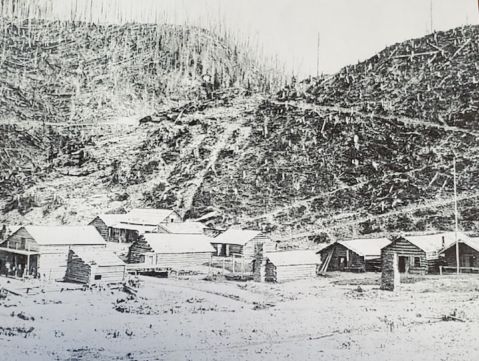
In this watershed, the gold in some places was so close to the surface that digging wasn’t even necessary. A miner could pan from two to 10 ounces of gold a day. Word soon got out, and the stampede was on. By late fall of 1860, prospectors were swarming all over the area. During that winter, a large number of miners survived in snow caves and were using fires to thaw the earth to extract gold from their claims. By the spring of 1861 every inch of the creek had been staked. The town of Antler which sprang up that year was quite impressive, with a hotel that offered caviar and champagne for the newly rich, a full racetrack featuring thoroughbred horses imported from Ontario, and a large sawmill proving dimension lumber for building construction. Antler remained the dominant community in the area until the Towns of the Goldfields shafts were punched down into the gold bearing gravel of Williams Creek to access its riches in the mid 1860s.
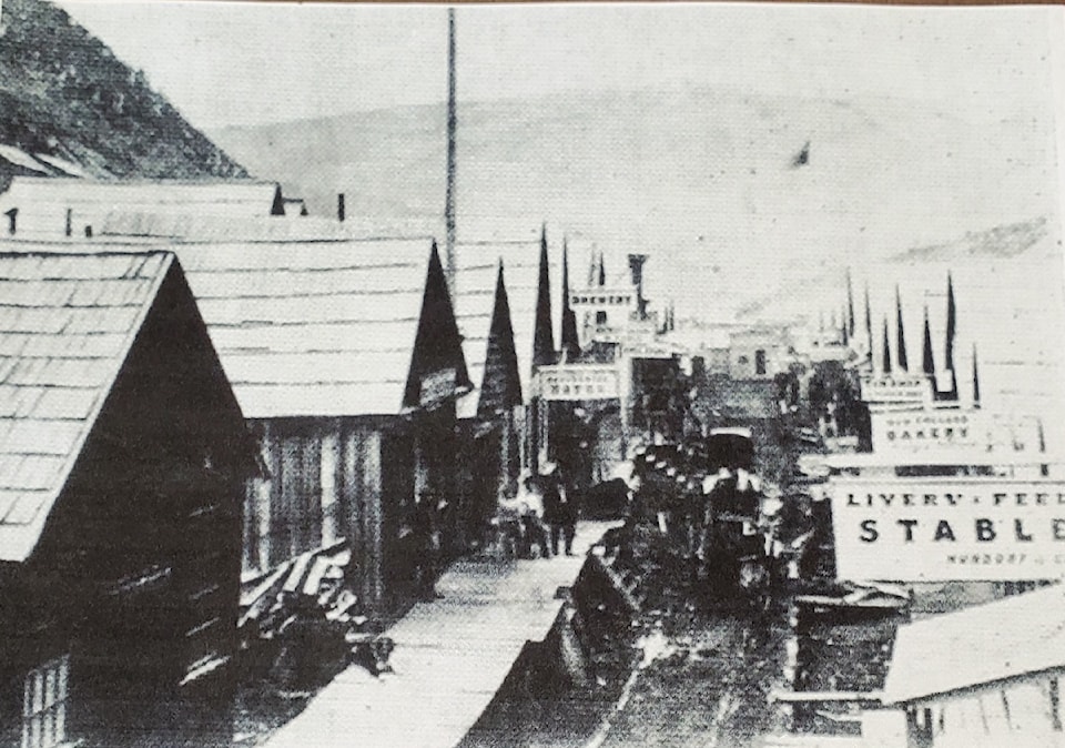
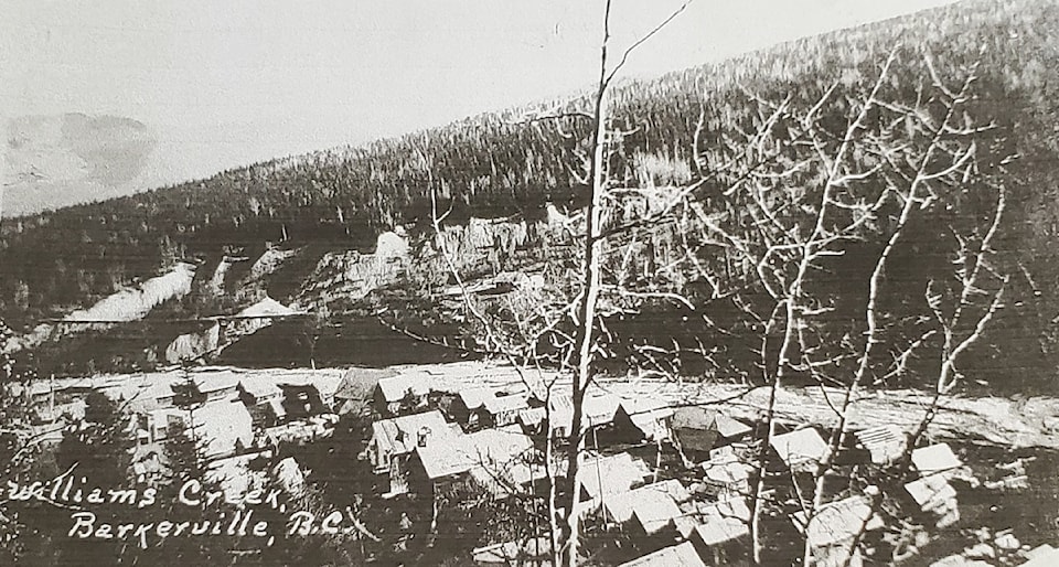
In the late fall of 1861, Williams (Dutch Bill) Dietz and three other partners discovered gold on an unnamed creek some 10 miles to the northwest of Antler. They named it after Dietz, and William’s Creek, with its seven miles of riverbed, tributaries and gulches would become the epicentre of the Cariboo gold rush. At the top end of the gorge, the first major community of the creek, the town of Richfield, was born in 1862. It was centred around a rich gold claim discovered by Bill Cunningham.
Very quickly, Richfield boasted several saloons, a jail, a courthouse, two banks, a Roman Catholic church, a French hotel, a BX freight office, a post office and several stores. The gold diggings in the area, however, proved to be fairly shallow,and they petered out quite quickly, causing people to migrate further north downstream as more gold strikes occurred and more people arrived into the region.
In reality, by 1864, there was virtually one long street of buildings extending along the west bank of Williams Creek, from Richfield at the south end to Marysville at the North. One writer noted that the path alongside the creek was “a difficult one, over endless sluices, flumes, and ditches; across icy planks and logs.” Just downstream, Richfield merged into Barkerville, which was often called Middletown by the locals. When Barkerville was seeking an official name, the two major contenders were Barkerville, after Billy Barker, around whose claim the town was centred, and Springfield, because of the many springs and bogs in the area where the town was built. Because of its central location, Barkerville was the community which became the largest and lasted the longest.
Where Barkerville ended, Camerontown began. This town was named after John “Cariboo” Cameron, who discovered a very rich claim on the creek in August of 1862. The substantial village which grew up around these diggings was officially christened in 1864 by Rev. Ephraim Evans.
Also present were the High Sheriff Peter O’Reilly, and the Assistant Gold Commissioner Williams Cox, and Judge Mathew Begbie. By the mid 1870s, Cameron town was in decline, and most businesses had folded or relocated to Barkerville.
The northernmost of the four towns along Williams Creek was Marysville, located at the lower end of the gorge just before where the waters drain into the swampy meadows. This was mainly a community of residences for miners and business folk, but it did have one major claim to fame. In 1863, after an extensive fundraising project in England and in Victoria, a three-bed hospital was constructed there, opening its doors that September.
The resident physician hired to look after this facility was Dr. A. W. Black, originally from London. Marysville also did not have a long life, and as the gold rush subsided, people moved on, leaving the town to wither and decay.
In 1866, following a promising gold strike, another instant town grew up on the banks of Grouse Creek, about seven miles southeast of Barkerville. This town was variously know as Grouse city, Kellyville (after Andrew Kelly and his wife, who operated a boarding house and restaurant there), or Heronville (named for William Heron, who was one the first miners to stake a claim on that creek).
The gold deposits in the area were rich, but access to them was plagued by litigation between the large extraction companies and the free miners. This continued until the Towns of the Goldfields 1868, when Judge Begbie ruled in favour of the big consortiums. Grouse City was largely abandoned by 1880, and virtually no sign of it remains there today.
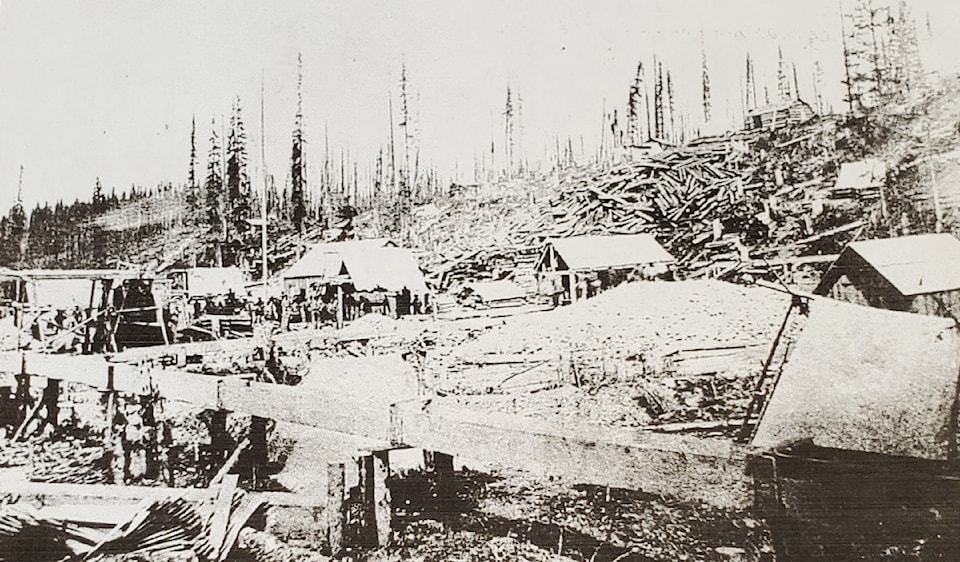
To the southwest of Barkerville on the Lightning Creek, large deposits of gold were found in1861 and 1862. By the autumn of 1862, a settlement was already flourishing there. Named Van Winkle after a small tributary stream emptying into Lightning Creek, it boasted a post office,saloons, hotels, gambling houses, blacksmiths, rooming houses, restaurants, bakeries,shoemakers, and more.
For a time, it appeared that Van Winkle would become the major supply point for all the mining activity in the region. It remained a vibrant boom town until 1870, when a new mining town, Stanley, was started only 1 ½ miles downstream, and then began its decline. Van Winkle survived until 1885, when a bypass road was built from Stanely to Barkerville. The townsite has now disappeared entirely, lost to several years of aggressive hydraulic mining.
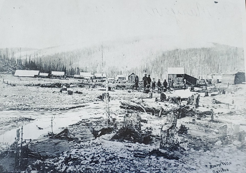
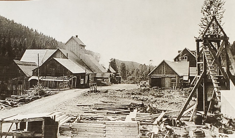
In 1870, three large mining companies began drilling to, and extracting from the gold bearing layer just above bedrock with very good results. This resulted in a mini gold rush on Lightening Creek and its tributaries, and a village quickly grew up on a flat area between two exploratory shafts. It was decided to name this new town Stanley, after Lord Stanley of Preston, The British Secretary of State of the Colonies. (This is the same Lord Stanley who became the Governor General of Canada and for whom the NHL’s Stanley Cup is named).
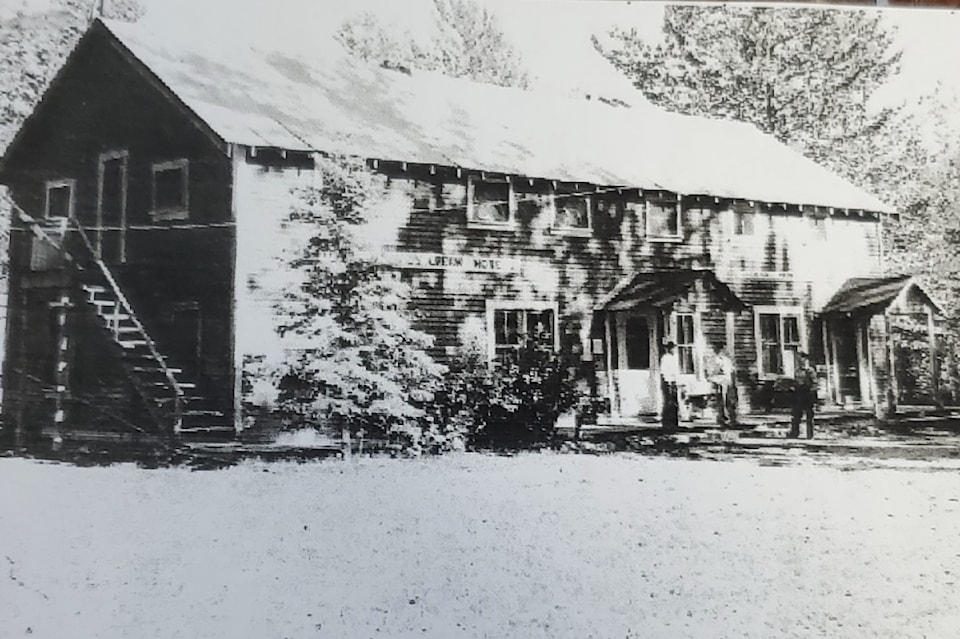
By 1873, Stanley’s population numbered about 1,000 half of it Chinese, and the number of businesses surpassed that of Barkerville. Several of the buildings, including a large hotel were simply skidded down the road from nearby Van Winkle, which was fast becoming a ghost town. Almost all of the structures in town were destroyed by a huge fire in 1924. Today, the only building left standing at the Stanley townsite is the Lightning Inn.
After the 1924 fire, this building, along with a number of other smaller ones were moved in from the defunct La Fontaine mine, some five miles to the southwest. The Inn remained in business until 1947. Stanley itself ceased to exist as a community around that time as well.
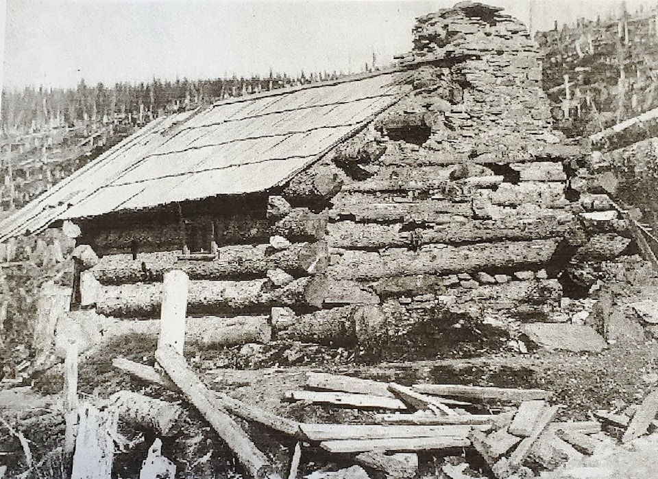
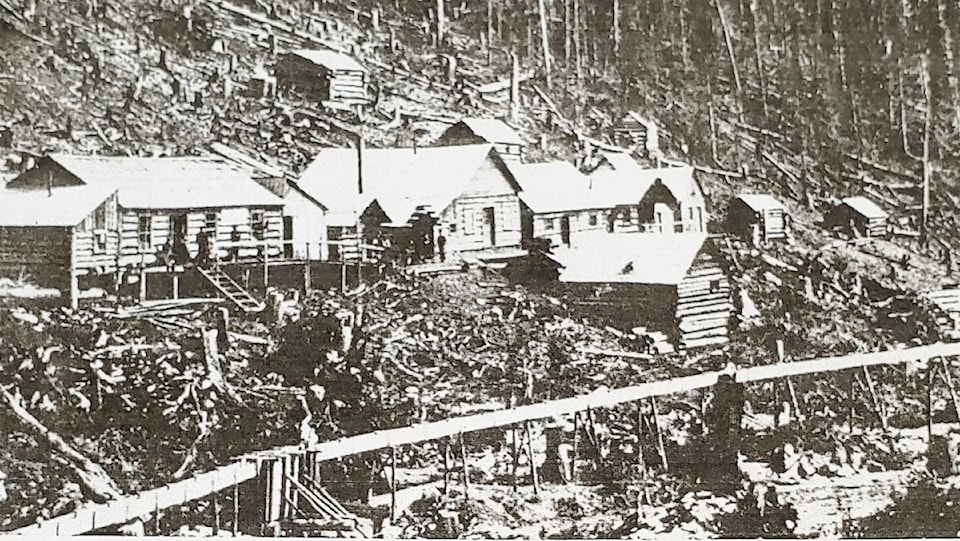
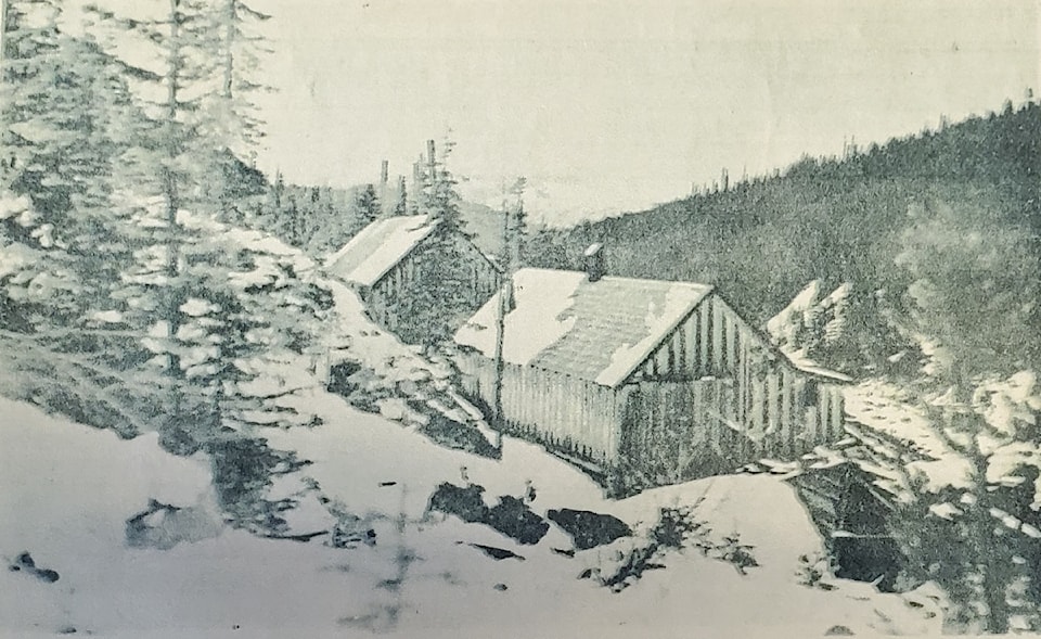
Further to the west along Lightning Creek was the town of Wingdam, so named for the wooden barriers, or “wings”, which were used to divert the waters of the creek and allow access to the gravel of the creek bed.
Placer miners worked the creek during the 1860s, but it was not until the early part of the 20th century that the technology and the engineering expertise were available to access the gold layer some 50 metres below. By the early 1930s, a substantial village had become established near the workings of the large Wingdam Mine. It was a company town, almost completely dependent upon the mining operation, although there were still a few independent placer miners who worked claims on the creek.
In the big mine, cave ins and flooding were constant problems, and the operations were often shut down, so Wingdam never did see the prosperity of a huge boom as did most other gold rush towns. In a century of off-and-on production, only 1,700 ounces of gold was extracted at the mine. A major fire in the 1970s destroyed the last structures remaining in the village.
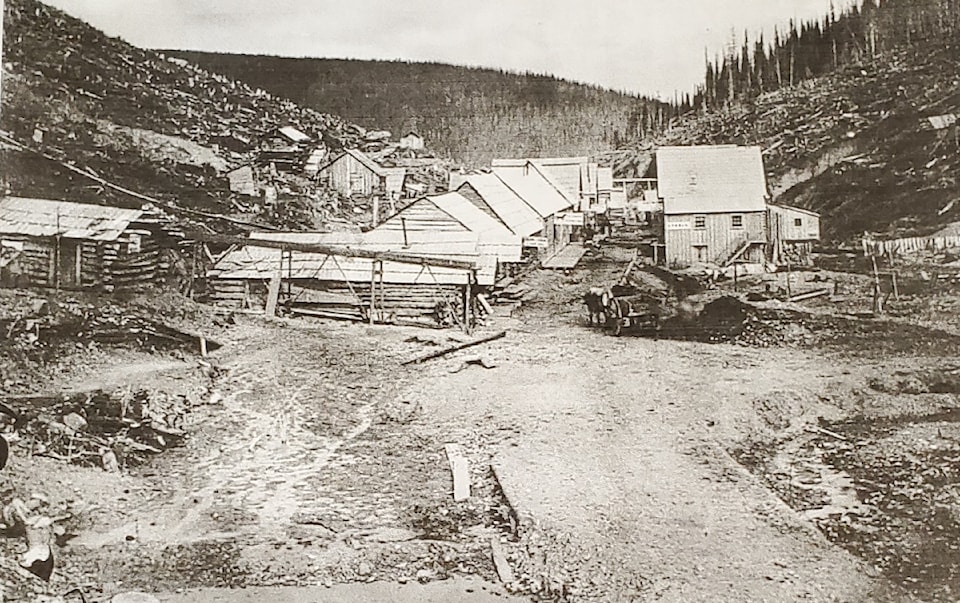
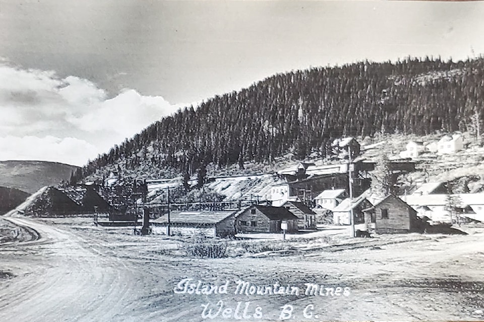
Finally, no list of gold rush towns would be complete without mentioning Wells, a gold mining community some eight miles northwest of Barkerville. It was named after Fred Wells, a mining engineer and hard rock miner who purchased a claim on Lowhee Creek in 1927, and began tunnelling into Cow Mountain. It took him 10 years, but he eventually found his bonanza. He and several investors formed the Cariboo Gold Quartz Company, which established a good sized mining operation, and the company town of Wells came into being. At its peak in the 1940s, Wells had a population of 4,500 and serviced two large mines, which extracted over $40 million in gold.
By 1967, however, the pay dirt was exhausted, and much of the town closed down as people moved on. In recent years, Wells has reinvented itself as a arts centre and a tourist destination. In the winter it now has about 150 residents, but this population increases to about 450 during the summer season.
There were many other small towns and villages associated with the gold strikes and mining operations in the Cariboo over the past 160 years or so. Places like Mosquito Creek, GroundhogCreek, and Lowhee Creek – all had their brief time in the limelight, but now are barely remembered. All that remains of these places today are the outlines of foundations, an occasional badly decayed structure, overgrown pathways, and dim memories.
For this article, I used information from Branwen Patenaude (Trails to Gold, Golden Nuggets), Art Downs (Wagon Road North), Marie Elliott (Gold in British Columbia), Photos from the B.C.Provincial Archives and from the public domain website entitled Williams Lake and CaribooChilcotin History.


